
The Pasvik valley from the upper room of the 96-Høyden tower, Svanvik, Sør-Varanger. August 2026.
Photo and text copyright © 2026 CM Cordeiro
The Pasvik valley in Sør-Varanger, Finnmark, carries several administrative descriptions at once. It is a watercourse regulated under hydropower concession, a national park with an associated visitor centre, an international boundary between Norway, Finland and the Russian Federation, and an agricultural district supporting a small number of working farms. I spent three days at NIBIO Svanhovd in August 2026. The observation set out below is a modest one, drawn from a short visit and resting largely on material that the valley publishes about itself: much of the work of holding the district together as a coordinated bio-based economy appears to be performed by artefacts that the governance literature does not ordinarily treat as instruments. Interpretation panels, a heritage designation, a national park visitor centre and a farm shop price list are among them.
Research on transboundary environmental governance is conventionally conducted at the scale of the basin or the treaty, and there are sound reasons for the convention, since formal instruments are constituted at those scales. My contention in what follows is that the convention under-describes Pasvik. The arrangements that appear to be doing coordinating work in the valley operate at a considerably finer grain, and a number of them are physical objects placed in the landscape for the instruction of residents and visitors.
The lookout tower at 96-Høyden
The tower stands on a rise above Svanvik, some fifteen minutes by road from the research station. It is a dark, tapering timber structure with a glazed viewing room at the top, and an interpretation panel is fixed to its outer wall. The history the panel sets out repays attention.
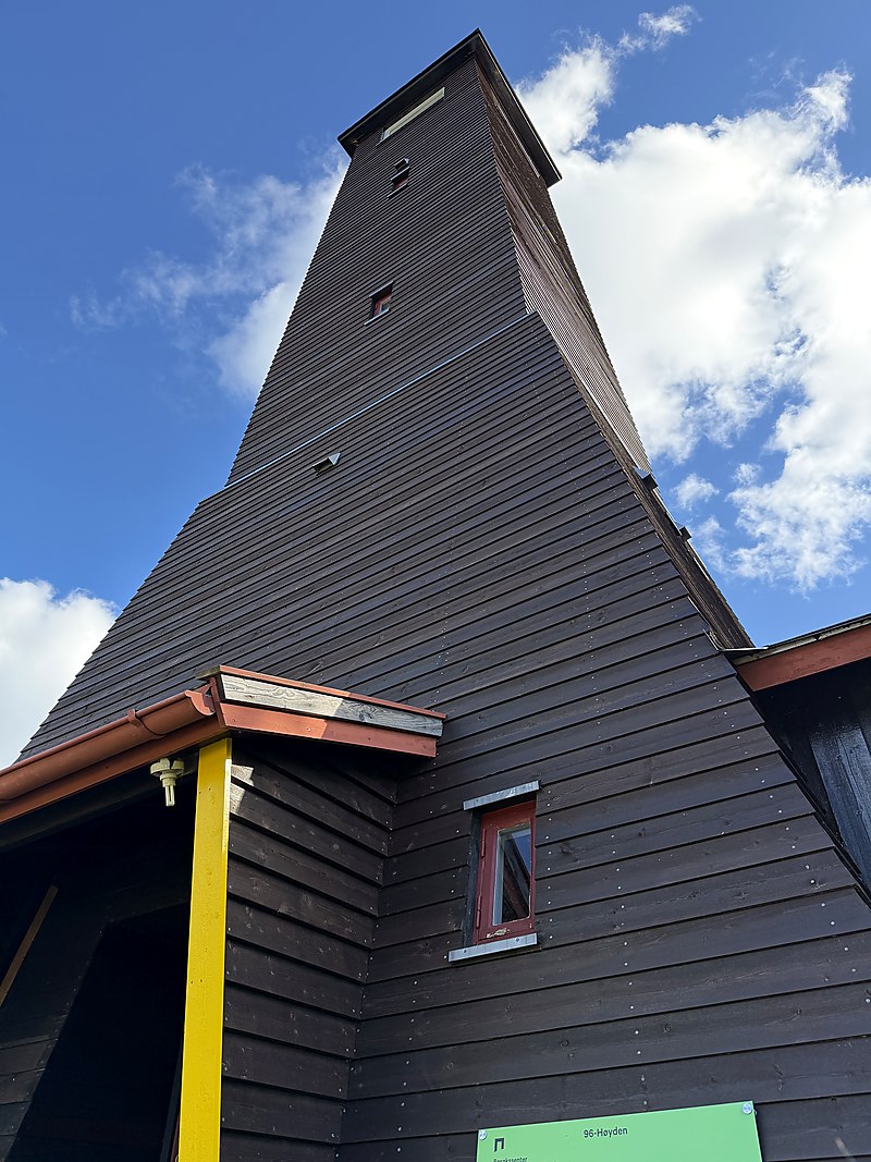
96-Høyden. The present tower dates from 1954 and is heritage-listed; a lookout tower built on the site in 1935 burned down in May 1944.
According to the panel, 96-Høyden has served as a lookout tower and a tourist attraction since the 1930s, when Finland, rather than the Soviet Union, was Norway’s neighbour on the eastern bank of the Pasvik river. The Norwegian government was at that period pursuing measures to promote settlement in the district, among them the encouragement of tourism. In order to attract travellers from both the Finnish and the Norwegian sides, the Ministry of Agriculture built a lookout tower at 96-Høyden in 1935. The Sør-Varanger tourist association subsequently rented the tower and operated a restaurant business from it.
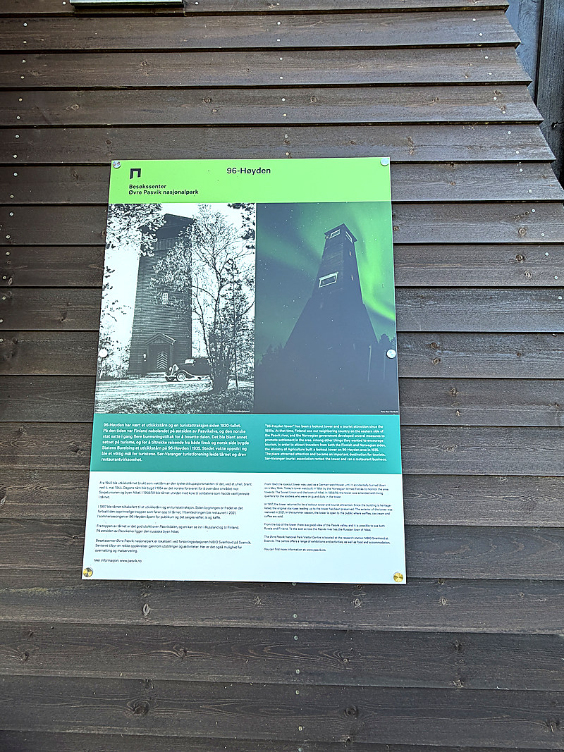
The interpretation panel fixed to the tower wall.
The identity of the builder is the detail of interest here. A border viewing platform was erected by the department of state responsible for agriculture, and was erected as an instrument of settlement policy. Border, farm and visitor were already administratively continuous in 1935, well before the vocabulary now used to describe integrated rural development had been formulated.
The subsequent sequence is given on the same panel. From 1940 the structure was used as a German watchtower, and it burned down accidentally on 4 May 1944. The present tower was erected in 1954 by the Norwegian Armed Forces for the purpose of monitoring the area towards the Soviet Union and the town of Nikel, and was extended in 1958 or 1959 with living quarters for the soldiers on guard duty. It reverted to use as a lookout tower and tourist attraction in 1997. The building is now heritage-listed, the original staircase has been preserved, the exterior was restored in 2021, and during the summer season the tower is open to the public and sells refreshments. Russia and Finland are both visible from the upper room, and Nikel lies to the east across the river.
A single structure has therefore served in turn as an instrument of agricultural settlement policy, as an occupying force’s observation post, as a Cold War surveillance installation, as a protected monument and as a seasonal café. The closing paragraph of the panel directs its reader to the Øvre Pasvik National Park Visitor Centre at the NIBIO Svanhovd research station at Svanvik. The tower now functions, among other things, as a referral mechanism to a research institute, which is a first indication that the coordinating node in this valley may be the visitor centre rather than any authority constituted at basin scale.
Regulation of the watercourse
The national park centre has installed a series of hinged wooden boxes along the nature trail at the water’s edge. Lifting the lid of each reveals a laminated panel. Most treat berries and plants of the district, among them tyttebær, molte, finnmarkspors, skrubbær and kvann. One treats the river.
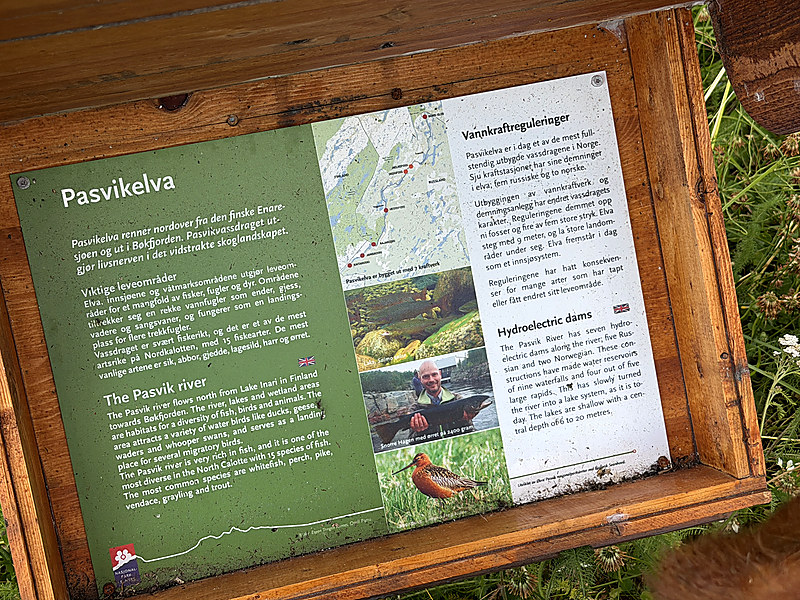
The Pasvikelva panel, one of a series of hinged wooden boxes installed along the nature trail by the national park centre.
The Pasvikelva panel sets out the regulation without circumlocution, in Norwegian and in English. The river rises in Lake Inari in Finland and flows north to Bøkfjorden. It supports fifteen fish species and is described on the panel as among the most diverse watercourses in the North Calotte, the commonest species being whitefish, vendace, grayling, perch, pike and trout. Seven hydroelectric dams stand along its course, five Russian and two Norwegian. These have impounded nine waterfalls and four of the five large rapids, with the consequence that the river now presents as a lake system whose lakes have a central depth of between six and twenty metres. The Norwegian text carries a sentence that the English translation omits, to the effect that the regulation has had consequences for many species which have lost their habitat or had it altered.
The panel is the most economical statement of the valley’s condition that I encountered anywhere on the visit. A Finnish headwater, a cascade divided between two other states, a shared fish stock and an ecological cost recorded in a subordinate clause are set out together on a single laminated sheet in a wooden box beside a footpath. The panel also carries a line of provenance at its foot: it was developed by the Øvre Pasvik national park centre at Bioforsk Svanhovd. Bioforsk was merged into NIBIO in 2015. The valley’s public account of its own hydrology thus continues to carry the name of an institution that has ceased to exist, which suggests that interpretation infrastructure has a longer institutional half-life than the organisations that commission it.
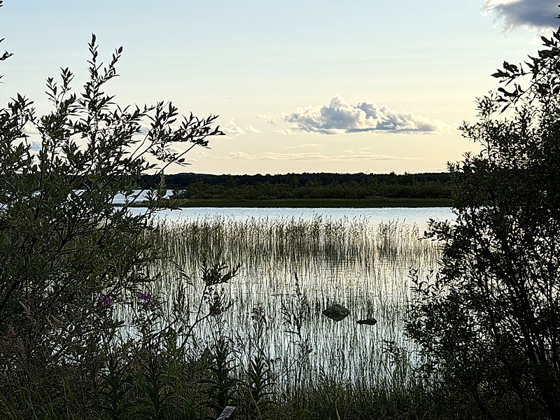
The Pasvik river at Svanvik. Seven hydroelectric dams along the course have given the watercourse the character of a shallow lake system.
There exists a formal architecture for the shared watercourse. The Pasvik-Inari Trilateral Park associates five protected territories across the three states and holds transboundary certification from the EUROPARC Federation. Vladimirova (2023), examining regional environmental governance across the three national systems, nevertheless finds that the certification rests on management philosophies that are not readily compatible, the Norwegian and Finnish areas being oriented towards sustainable use consistent with reindeer herding and tourism while the Russian zapovednik proceeds from what she characterises as a fortress conservation model. She observes further that regional cooperation has been mobilised to legitimate industrial pollution, and that tourism development remains constrained by the border regime. The formal frame is accordingly less substantial than its certification would imply, whereas the interpretive and institutional work conducted at ground level is comparatively dense.
Interpretation as an allocative instrument
The wooden boxes merit consideration as instruments rather than as visitor amenities. Each advances a claim about the proper use of the valley. The berry panels present a landscape that is harvestable and whose usable species have names. The river panel presents a constructed system with proprietors in two jurisdictions. The information board at the landing, with its Perletur route and its notices, presents the shoreline as a public good accompanied by a prescribed manner of moving through it.
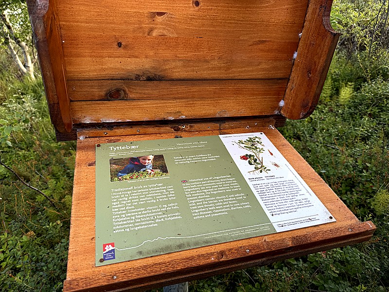
A trail box opened at the panel for tyttebær.
In their review of the literature, Bugge, Hansen and Klitkou (2016) distinguish three visions of the bioeconomy: a biotechnology vision, a bio-resource vision organised around biomass value chains, and a bio-ecology vision organised around sustainability, biodiversity and circularity. The interpretation infrastructure at Pasvik performs bio-ecology work in an unusually literal sense, in that it informs residents and visitors which biological resources may legitimately be taken, on what terms and within what ecological limits. Allocation of this kind is a governance function, however modest the material form in which it is delivered.
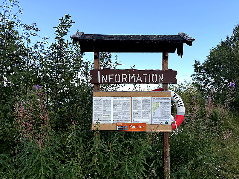
Information board at the landing, carrying the Perletur route.
The arrangement is also polycentric in the sense developed by Nagendra and Ostrom (2012) for multifunctional forested landscapes. Their objection to blueprint thinking applies here with some force. No single level of organisation, whether trilateral certification, national park administration or municipal planning, accounts on its own for the manner in which the valley is held together, and outcomes depend on the interactions between levels, some of which are mediated by a laminated sheet inside a spruce box.
Dairying at Øverli
Ostemaker Øverli, at Øverli gård in Svanvik, lies a few minutes further down the valley. Silage bales stand in the surrounding fields, cattle feed at a rail outside the barn and are housed in the byre behind it. A small counter inside sells cheeses made on the holding and sold under their own names, among them Gaivo, Kvit Gardsost, Tomé Pasvik, Barents Best, Raclette Pasvik and Farmesan, together with a kettle-boiled fløtemysost whose label records a regional product award from 2010. The framed price list on the wall is dated 1 July 2026.
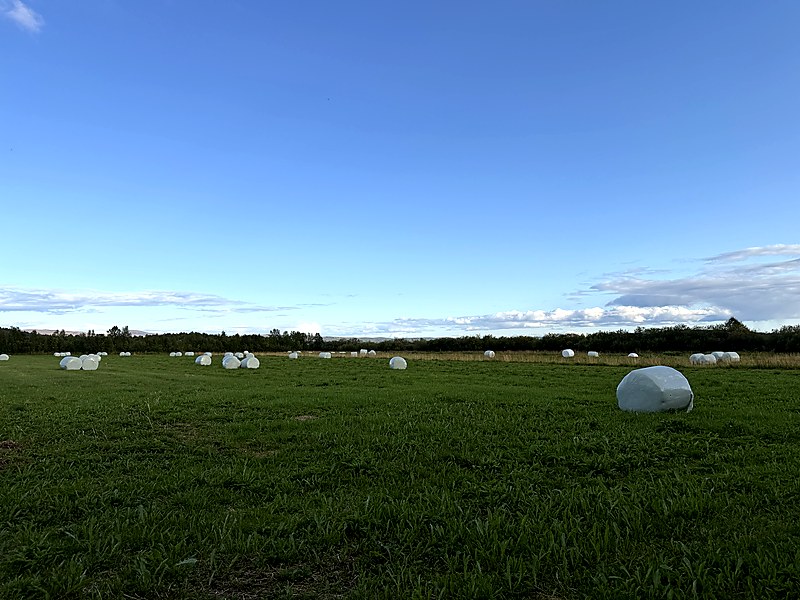
Silage bales on the Pasvik floodplain, Svanvik.
The holding contains the whole of the valley’s bioeconomy in miniature: grass grown on a border floodplain, a dairy herd, processing on site, differentiated products, a point of sale, and a set of proprietary names that perform a quiet territorial function. Tomé Pasvik, Raclette Pasvik and Barents Best each attach the product to a named space, the last of them to a maritime region rather than to a village.
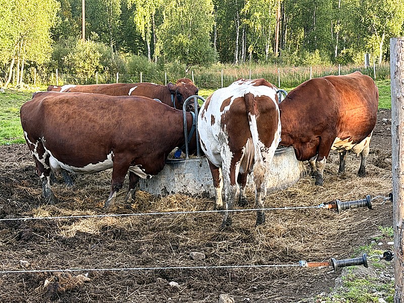
Dairy cattle at the feed rail, Øverli gård.
Dubois (2019), writing on short quality food chains among farmers in northern Sweden, argues that producers in peripheral locations do not operate within geographical proximity alone. They construct what he terms translocal practices, mobilising organisational, cognitive and social proximities across distance and communicating directly with consumers in place of certification infrastructure that is physically remote. The naming strategy at Øverli is consistent with that account.
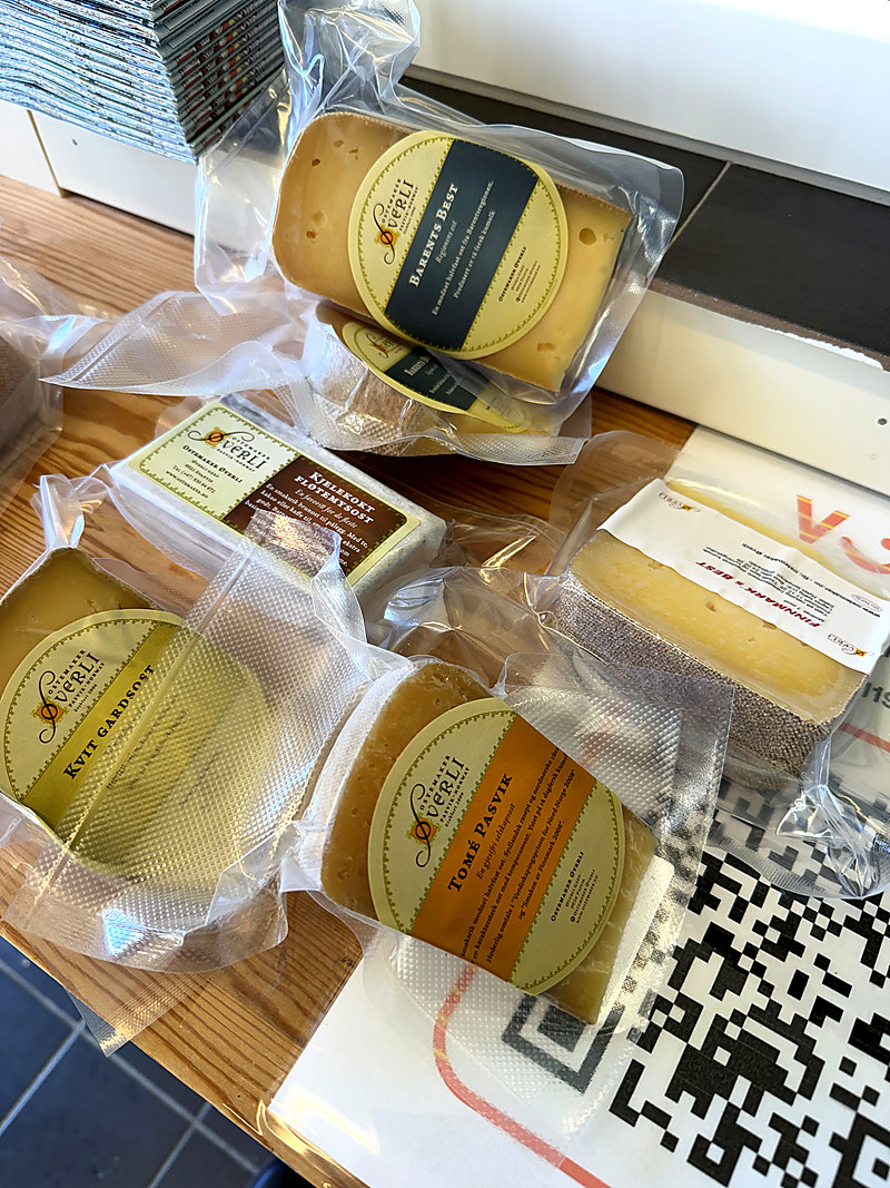
Cheeses from Ostemaker Øverli. Seven products are made from the milk of a single herd.
For work on circular bioeconomy and nutrient recycling the holding is also the point at which the abstractions become tractable. Nutrient flows in this valley are not in the first instance a modelling problem. They are grass, silage, a herd, manure and a watercourse that three states have already engineered. On the evidence available to me, the scale at which a nutrient loop might realistically be closed in Pasvik is that of this farm and its neighbours rather than that of the basin.
Skoltebyen and the demarcation of 1826
Forty minutes to the west, at Neiden, the Skoltebyen site (Sää’msijdd, Kolttakylä) holds two designations concurrently. It is a protected cultural monument area, and it is a utvalgt kulturlandskap, a selected agricultural landscape. The interpretation board on the site sets out a sequence recognisable from the literature on common-pool resources.
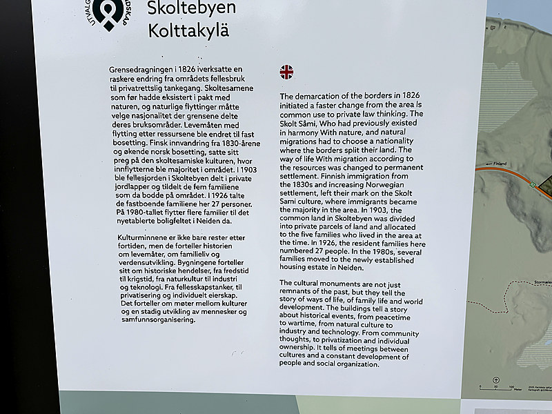
Detail of the interpretation board at Skoltebyen, Neiden. The Norwegian and English texts date the shift from common use towards private law thinking to the border demarcation of 1826.
The demarcation of the borders in 1826, the board states, initiated a more rapid change from the common use of the area towards private law thinking. The Skolt Sámi, whose way of life had involved migration according to the availability of resources, were obliged to choose a nationality where the borders divided their land, and were moved towards permanent settlement. Finnish immigration from the 1830s and increasing Norwegian settlement followed, and immigrants became the majority population of the area. In 1903 the common land at Skoltebyen was divided into private parcels and allocated to the five families then resident. The resident families numbered 27 persons in 1926. During the 1980s several families moved to a newly established housing estate at Neiden.
A boundary drawn for reasons of state thus converted a functioning multi-state resource system into private parcels within some eight decades. A related argument is advanced for Finnmark more generally by Bjørklund and Marin (2015), who hold that the legal category of the commons was applied to Sámi siida territories which in practice operated through well-defined exclusive rights combined with negotiated flexibility, and that the resulting misfit has been reproduced through successive rounds of institutional bargaining, layering and bricolage, including in the Finnmark Act of 2005. What the Skoltebyen board narrates as a local sequence appears on this reading to be an instance of a general mechanism, in which a border alters not merely the division of a resource but the property logic through which it is held.
The mechanism has not ceased to operate. Huntington et al. (2017), synthesising thirteen cases of small-community response to environmental change, include the Skolt Sámi of the Näätämö watershed, who initiated the first collaborative management plan for that river in response to declining salmon stocks and did so from within their own knowledge system. The population whose common land was parcelled in 1903 is now party to the co-management of a transboundary fishery. Whether the heritage designation at Skoltebyen contributes to that recovery or principally documents the loss is a question I am not in a position to answer from a single visit.
Implications
Transboundary bioeconomy governance is customarily theorised at basin scale. The basin-scale instruments at Pasvik exist and are consequential, but they are also fragile, asymmetrically constituted and, on one of the three sides, largely suspended since 2022. What has persisted is carried by less conspicuous and more durable arrangements: a heritage-listed tower that refers its visitors to a research station; a national park centre that publishes the valley’s hydrology on laminated sheets in wooden boxes; a selected-cultural-landscape designation at Neiden; and a farm that converts grass grown on a border floodplain into seven named cheeses.
If this reading holds, the appropriate unit of analysis for a border bioeconomy is the interpretive and institutional infrastructure through which the population of a valley is informed what the catchment is, rather than the catchment itself. The proposition is testable. It predicts that transboundary coordination over bio-resources will survive political rupture more successfully where visitor centres, protected designations and small processors are densely distributed than where treaty instruments alone obtain. It implies in addition that research institutes carrying public visitor functions, of which NIBIO Svanhovd is one, should be counted among the governance actors in such settings and not solely among the producers of knowledge.
These are observations from three days in one valley, and the material on which they rest is in large part the valley’s own published account of itself. They are offered as a hypothesis for testing rather than as a finding.
References
Bjørklund, I., & Marin, A. (2015). A tragedy of errors? Institutional dynamics and land tenure in Finnmark, Norway. International Journal of the Commons, 9(1), 19–40. https://doi.org/10.18352/ijc.586
Bugge, M. M., Hansen, T., & Klitkou, A. (2016). What is the bioeconomy? A review of the literature. Sustainability, 8(7), 691. https://doi.org/10.3390/su8070691
Dubois, A. (2019). Translocal practices and proximities in short quality food chains at the periphery: The case of North Swedish farmers. Agriculture and Human Values, 36(4), 763–778. https://doi.org/10.1007/s10460-019-09953-y
Huntington, H. P., Begossi, A., Fox Gearheard, S., Kersey, B., Loring, P. A., Mustonen, T., Paudel, P. K., Silvano, R. A. M., & Vave, R. (2017). How small communities respond to environmental change: Patterns from tropical to polar ecosystems. Ecology and Society, 22(3), 9. https://doi.org/10.5751/ES-09171-220309
Nagendra, H., & Ostrom, E. (2012). Polycentric governance of multifunctional forested landscapes. International Journal of the Commons, 6(2), 104–133. https://doi.org/10.18352/ijc.321
Vladimirova, V. (2023). Regional environmental governance of protected natural territories in the European North: Russia, Finland, and Norway, and the case of Pasvik-Inari Trilateral Park. Climatic Change, 176, 85. https://doi.org/10.1007/s10584-023-03559-4